Mapping Inequality Poster
1935-1940
- Mapping Inequality Poster
- Released: 2016
About the Project
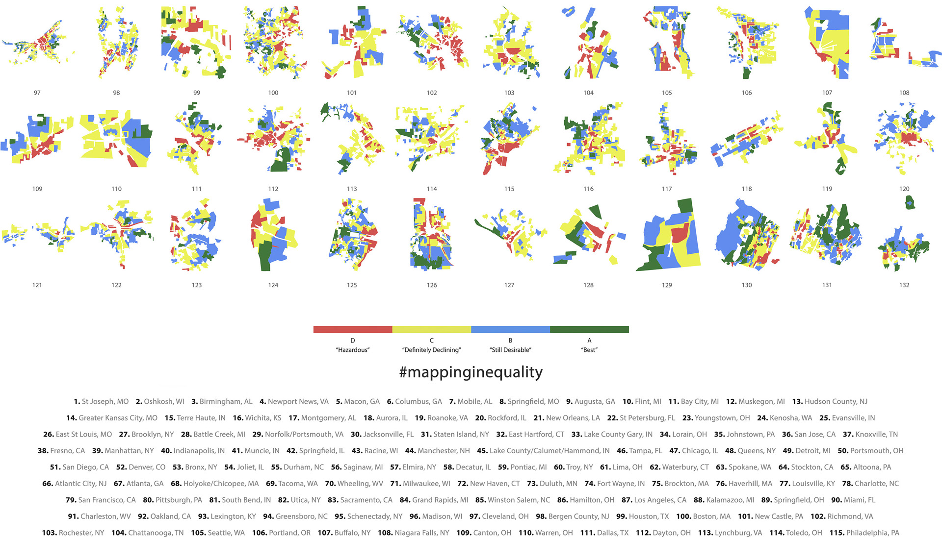
This poster shows small multiples of cities at the neighborhood level, graded by the Home Owners Loan Corporation. Known as HOLC, the organization created “security maps” that color-coded, graded, and identified credit worthiness and their risk of defaulting on mortgage loans in cities across the U.S between 1935 and 1940. They ranked cities from most “Hazardous” (1. St Joseph, MO) to “Best” (132. Darien/New Canaan/Stamford, CT) based on the amount of area designated A, B, C, or D.